Predict the future by creating it
You didn’t come this far to stop


Trusted by Industry Leaders Worldwide
★★★★★
Innovative Drone and GIS Solutions
At DEORC-AI, we leverage cutting-edge drone technology and advanced rendering techniques to provide innovative solutions tailored to your needs. Our services combine technical expertise with creative flair, ensuring that we deliver unparalleled quality and precision in every project. Explore our comprehensive suite of services designed to elevate your projects to new heights.


10+
100%
Custom made
AI models
Our Solutions
Advanced aerial photography and GIS services tailored for agriculture, construction, and research sectors.
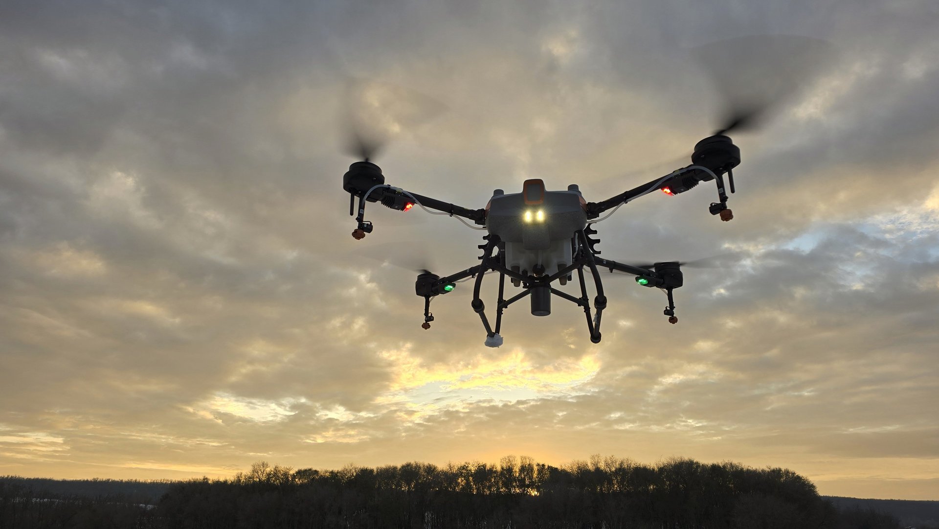
Aerial Photography Services
Capture stunning, high-resolution aerial images with our 4K camera-equippeddrone. Whether for marketing purposes or accessing hard-to-reach areas, our aerial photography services provide breathtaking visuals that showcase your project from a unique perspective. With the ability to use near-infrared and infrared band sensors, we offer specialized imaging for in-depth analysis and creative projects.


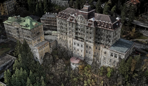
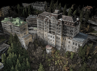
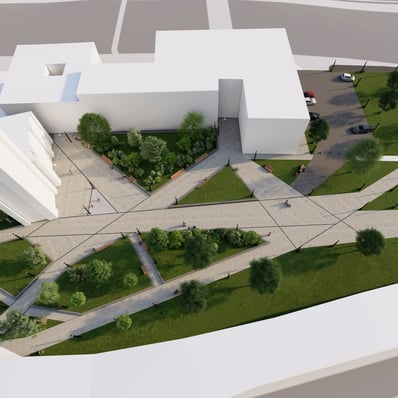
3D Modeling & Photogrammetry Services
Transform your site into a detailed 3D model with our photogrammetry services. Ideal for land surveying, construction projects, and structural studies, our high-resolution imagery enables accurate terrain mapping and structural analysis. Visualize your projects with precision and gain valuable insights into your site’s topography and features.
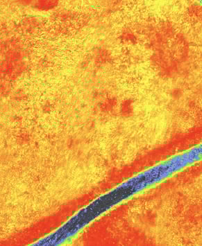
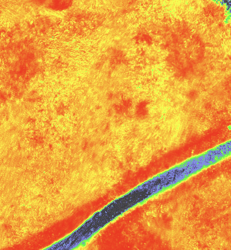

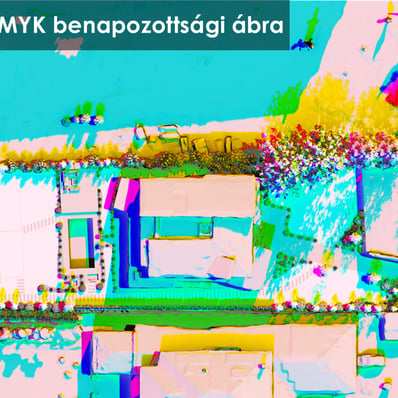
NDVI Analysis and Height mapping
Harness the power of our DJI Mavic 3M drone for advanced NDVI (Normalized Difference Vegetation Index) analysis. Our multispectral camera technology enables precise plant monitoring and data acquisition, empowering you to assess plant health, monitor growth conditions, and optimize watering practices. By analyzing vegetation vigor, we help you identify areas that need attention and maximize crop yields. Whether for archaeological sites, construction projects, or land development, our height maps ensure you have the precise data you need for successful project execution.


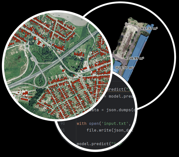
AI Site Analysis
Utilize our cutting-edge AI-driven site analysis for in-depth project insights. Our advanced AI methods, including automatic object recognition, deliver precise analysis tailored to your unique requirements. From identifying features to conducting thorough assessments, our AI solutions empower you to make informed decisions with confidence.
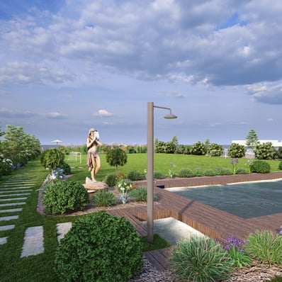
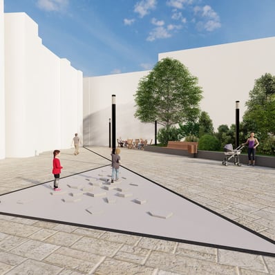
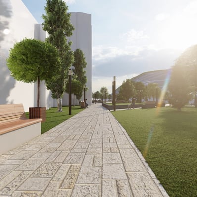
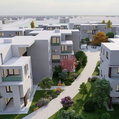
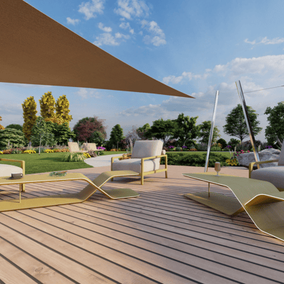
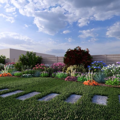
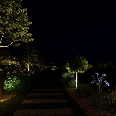
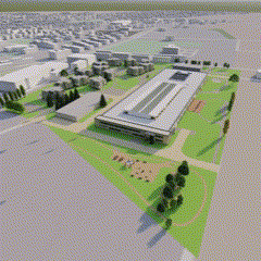
Immersive Visualizations and Animations
Bring complex data to life with our rendering and visualization services. By combining drone data with state-of-the-art rendering techniques, we create immersive visualizations and animations that make your data accessible and visually engaging. Our expertise, honed through teaching at the university level, ensures that your projects are presented in the most compelling manner possible.

Our Partners


DEORC-AI
Innovative drone and GIS services for industries.
Contact
© 2025. All rights reserved.