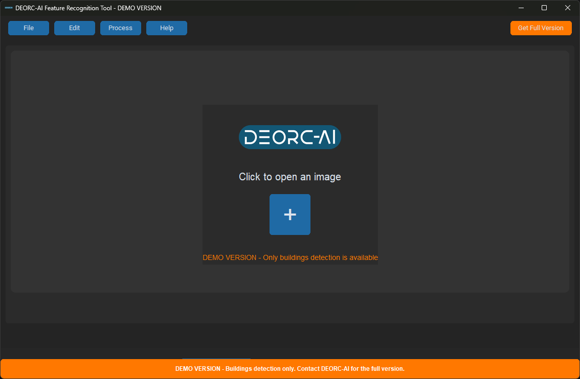
What is the DEORC-AI Feature Recognition Tool?
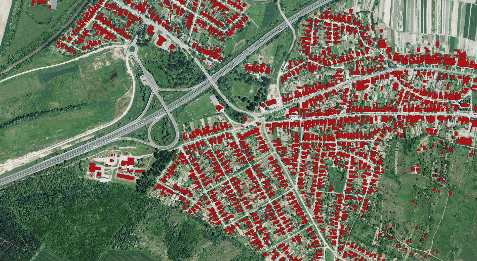
The DEORC-AI Feature Recognition Tool is a powerful desktop application that enables automated feature detection in satellite imagery using cutting-edge artificial intelligence. Whether you're analyzing urban development, tracking environmental changes, or experimenting with geospatial AI, this demo version offers an intuitive and capable environment to explore AI-driven image processing.
Key Features
🛰️ Interactive Image Preview
Navigate and explore high-resolution satellite imagery with smooth, user-friendly controls.
🧠 Smart AI Model Selection
Choose from built-in pre-trained models for detecting buildings, solar panels, or trees—or connect your own custom AI models in the full version.
🎯 Confidence Control
Fine-tune detection sensitivity using a real-time confidence slider for precise results.
🔍 Efficient Image Tiling
Automatically break down large satellite images into smaller, manageable tiles for streamlined processing.
🌍 GeoJSON Export
Export your detection results in the widely-supported GeoJSON format for integration with GIS tools and workflows.
🔗 Custom API Integration (Full Version Only)
Easily connect to your own Roboflow projects for extended functionality.
Quick Setup
Download and run the installer: DEORC-AI_Feature_Recognition_Tool_Demo_Setup.exe
Follow the on-screen instructions
Launch from your desktop or Start menu and start detecting
Minimum Requirements
Windows 10 or later
4 GB RAM (8 GB recommended)
500 MB disk space
Internet connection for AI model access
⚠️ Note: This is a demo version intended for evaluation purposes. Custom model integration and advanced features are available in the full version. For commercial or production use, please contact DEORC Ltd.
Download the demo today and discover the potential of AI-enhanced satellite imagery analysis.
© 2025 DEORC Ltd. All Rights Reserved.
DEORC-AI
Innovative drone and GIS services for industries.
Contact
© 2025. All rights reserved.